
Singapore Expat Rental
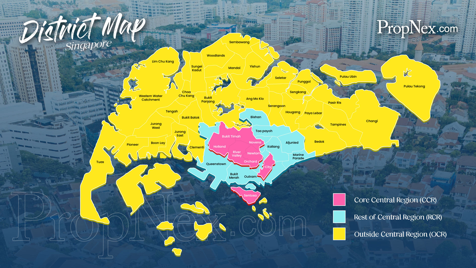
Singapore District Map
Knowing Singapore's postal districts is the first step to choosing where to live, and Singapore Expat Rental uses this map daily when shortlisting homes for expatriates. Explore the regions below, then see homes by district.
Singapore District Map provides all 28 districts (under the old district numbering system) that covers the entire Singapore mainland & Sentosa Island
Click here for interactive Singapore Map: * SLA StreetMap@Singapore * 
| District and Location |
Postcodes
|
| District 01 – Cecil, Marina, People’s Park, Raffles Place |
Sector 1-21
|
| District 02 – Anson Rd, Tanjong Pagar | |
| District 03 – Alexandra, Queenstown, Tiong Bahru | |
| District 04 – Habourfront, Mount Faber, Telok Blangah, WTC | |
| District 05 – Clementi, Dover, Pasir Panjang, West Coast | |
| District 06 – Beach Rd, High Street | |
| District 07 – Golden Mile, Middle Rd | |
| District 08 – Little India | |
| District 09 – Cairnhill, Orchard Rd, River Valley |
Sector 22-27
|
| District 10 – Ardmore, Bukit Timah, Farrer, Holland, Tanglin Rd | |
| District 11 – Novena, Newton, Thomson, Watten Estate |
Sector 28 -30
|
| District 12 – Balestier, Serangoon, Toa Payoh |
Sector 31-41
|
| District 13 – Macpherson, Braddell | |
| District 14 – Geylang, Eunos, Sims, Paya Lebar | |
| District 15 – Amber Rd, Joo Chiat, Katong, Marine Parade, Meyer, Tanjong Rhu |
Sector 42-48
|
| District 16 – Bayshore, Bedok, Siglap, Upper East Coast Rd, Eastwood, Kew Dr | |
| District 17 – Changi, Flora, Loyang |
Sector 49-52 + 81
|
| District 18 – Tampines, Pasir Ris, Simei | |
| District 19 – Serangoon, Hougang, Punggol, Sengkang |
Sector 53-57
|
| District 20 – Ang Mo Kio, Bishan, Braddell, Mei Hwan, Thomson | |
| District 21 – Upper Bukit Timah, Ulu Pandan |
Sector 58 -59
|
| District 22 – Boon Lay, Lakeside, Jurong |
West Sector 60-70
|
| District 23 – Bukit Panjang, Choa Chu Kang, Bukit Batok, Dairy Farm, Hillview | |
| District 24 – Lim Chu Kang | |
| District 25 – Kranji, Woodgrove, Woodlands |
North Sector
71-80,82,83 |
| District 26 – Springleaf, Upper Thomson | |
| District 27 – Sembawang, Yishun | |
| District 28 – Seletar, Yio Chu Kang |
Need help finding a home?
Call +65 9222 9919 or send your requirements and I'll be in touch.
Contact Kris